Wonders & Monuments · Great monuments
Hadrian’s Wall
The Roman frontier wall across northern Britain, begun under Hadrian, now a ruin in open country.
In ruins. Long stretches of the wall, milecastles and forts survive as ruins, especially in Northumberland. Much of the original line is only a bank, a ditch, or a mark in later fields. The wall is a frontier work, not a city wall around Rome.
What it is
Hadrian’s Wall was begun around AD 122, in the reign of the emperor Hadrian, as a fortified line across northern Britain from the river Tyne to the Solway Firth. It was of stone for much of its length, with a ditch, a mound, milecastles, turrets and larger forts such as Housesteads. It marked a limit of Roman power, and it was manned by soldiers, not by a city’s population. The wall never enclosed the whole of the island; it cut across it.
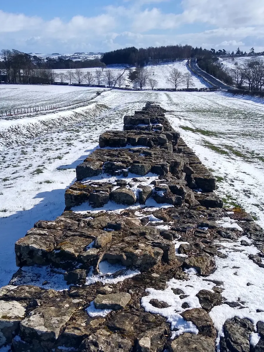
What remains varies from place to place. In the Northumberland uplands the stone curtain still runs over crags and pastures. Elsewhere only the ditch or a low ridge is left. The photographs here show standing stretches in the open, not a complete barrier from sea to sea. There is no contemporary memoir of Hadrian in this library that describes the wall; the work must be read from the stones and from later study.
Why it matters
This is costly labour spent on a frontier: a line of discipline and defence, not a temple or a tomb. The virtue to notice is perseverance — mile after mile of wall, ditch and posts — and the honesty to see that empires have edges, and that those edges are built by many hands.
Look closely
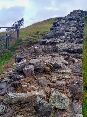
Image: Wikimedia Commons · CC0 (public domain) The wall east of Walltown Quarry
Look closely. Looking along a standing stretch of the wall in Northumberland, with the stone curtain running over rough ground and the country falling away beyond. You can see the thickness of the remaining courses and the way the line follows the land, not a straight ruled cut.
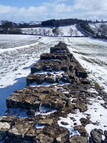
Image: Wikimedia Commons · CC0 (public domain) Hadrian’s Wall at Blackcarts
Look closely. Another Northumberland stretch, at Blackcarts near Chollerford, looking east along the wall. The stonework is close and weathered. Compare the height and the facing with the Walltown view, and notice how much of the upper work is gone.
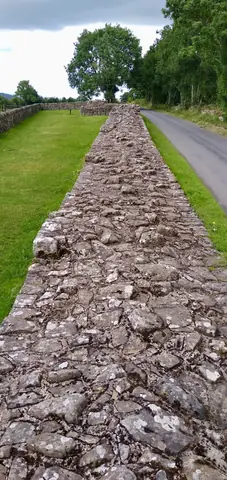
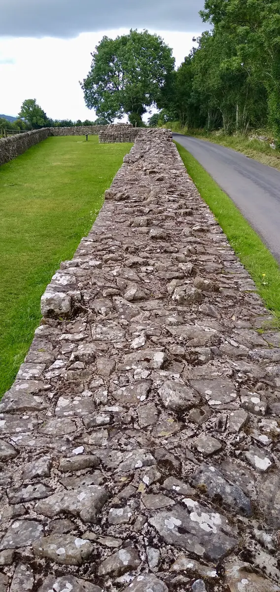
Image: Wikimedia Commons · CC0 (public domain) The wall at Banks East, Cumbria
Look closely. A quieter length near Banks East, west of the Northumberland crags, where the remains run beside a green path. The wall here is lower and less dramatic, which is part of the truth of the monument: it is a long line, not only a cliff-edge ruin.


What to watch for
Look slowly- A ruin in the landscape. The wall is no longer a complete barrier. Look for the standing curtain, and for gaps.
- Ditch and mound. The stone face was only part of the system. In some views a ditch or a later path runs beside the remains.
- Different stretches. Walltown, Blackcarts and Banks East are not the same place. The work changes with the ground.
- Scale. Notice how low some surviving courses are, and how the wall follows the rise of the land.
- Not a city wall. This is a frontier across a country, with forts and milecastles at intervals.
Sources
Dates follow standard historical references and, where we quote a book, the wording of the edition hosted in this library. Photographs are used only when the photograph itself is Public domain, CC0, or CC BY with a named credit. Lost wonders are shown in later engravings and reconstructions, which are imaginings, not photographs of the original work. Each picture links to its source page with full licence details.